Other pages you may find of interest |
The ruins of Thurburbo Maius are located in northern Tunisia near the city of El Fah about 50 km southwest of Tunis and 60 km from Tunisias most famous archaeological site of Carthage.
The origins of Thurburbo Maius date back to 27 BC during the reign of the Roman emperor Augustus (27 BC 14 AD) when it was founded on the site of a Punic settlement as a place for Roman military veterans on their retirement from the Legion. It was customary to grant land to the army personnel on their retirement in order for them to maintain a presence in the area as much as to reward them for their service. The location of Thurburbo Maius was chosen due to its strategic position and access to trade routes, something that ensured its economic success. Thurburbo Maius or Colonia Julia Aurelia Commoda, as it was known as during Roman times, continued to develop during the Roman period with significant expansion occurring between 150 - 200 AD due to its grain, olives, and fruit production, making it a thriving town of up to 10,000 people. Under the Emperor Hadrian (117 138 AD) it became a municipium (the second-highest rank of Roman city) while under the Emperor Commodus (177 180 AD) it was made a colonia, the highest rank of Roman city that would grant its citizens Roman citizenship. It did undergo a decline during the 3rd century but underwent a resurgence in the 4th century.
The ruins themselves are located away from the proximity of any other buildings or conurbation and therefore lay undisturbed for many centuries. The excavation of the site started in the early 20th century and is on on-going process, although with limited resources for the work priority is going to some of the more prominent sites in Tunisia resulting in only a fraction of the remains having been excavated.
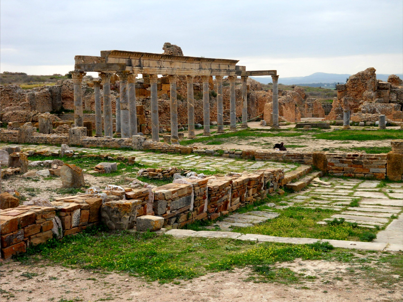
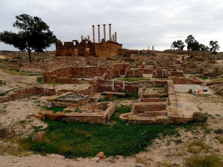
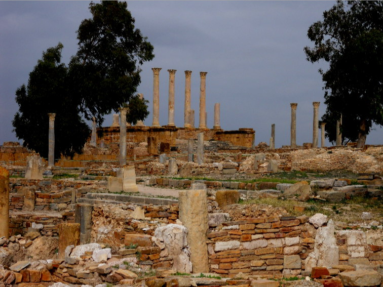
On entry to the site visitors see the Capitolium, the temple dedicated to the three main Roman gods of Jupiter, Juno and Minerva. All that survives of the Capitolium are the steps up to the main platform, four restored Corinthian columns of the front façade and the remains of the side columns.
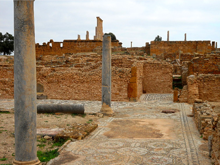
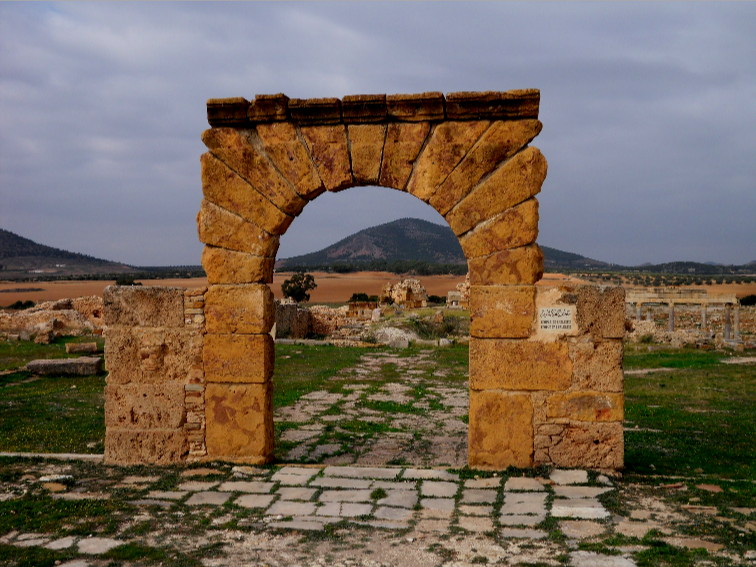
To the side of the Capitoliun are a number of houses with their walls rising about a metre, which is sufficient to enable the size of the dwellings and floor plans to be discerned. In fact the excavations at the site does not show any restored buildings. Overlooked by the Capitolium is the forum and a number of other Temples including that of the Temple of Saturn with the remains of an arch and several gates in the vicinity; the Temple of Caelestis (Carthaginian moon goddess) and the Temple of Baalat (Carthaginian Goddess) with its two columns rising from the corners of its platform. One building which does have columns topped by lintels is the Palaestra (gymnasium); this is situated next to one of the two public bath houses with its twenty rooms and mosaic floors.
A short walk away from these buildings is the Amphitheatre, as was common in antiquity this was constructed by excavating a suitable hill, which reduced the amount of masonry construction work. The Amphitheatre has still to be excavated; as does the water cistern which is located adjacent to the Amphitheatre.
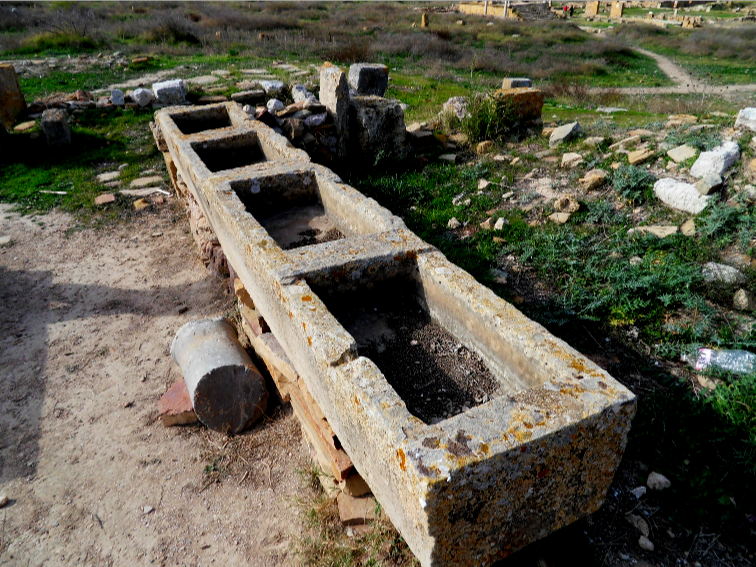
The layout of the streets is not the normal grid system used in Roman towns but of an irregular system which bears witness to its development from Punic to Roman. Confirmation of its industry is confirmed in several locations where large blocks of masonry used in the process of olive pressing and storage tanks can be seen. A number of finds at the site have provided additional evidence as to life in the Roman Empire during its occupation.
The journey to the site also is of archaeological interest as the road runs along the aqueduct which transferred the water from a steam in the hills to Carthage in the days of Roman rule. This is currently undergoing renovation so in places it enables it to be seen as it was in Roman times, showing how it was constructed. It would have been covered to prevent the water evaporating and being polluted and would have access provided periodically along the aqueduct.
To see more photographs and take a virtual tour of the site click on the photoshow below.

| Site Map |