|
|
||||||||||||
|
|
||||||||||||
|
|
|||
|
|
Kotor 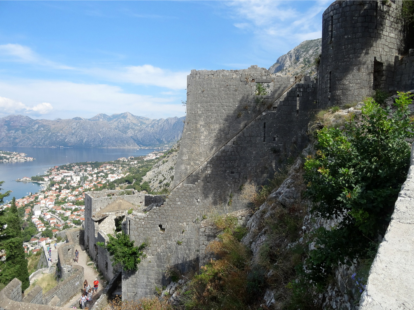
Perched on the mountain above the City of Kotor the Castle of San Giovanni or St. John, occupies a location that has been fortified in some form since antiquity. In the 6th century the fortress was reconstructed by the Byzantine emperor Justinian I. In 1420 the area - which was at that time the independent Republic of Cattaro - came under Venetian rule, this resulted in the fortifications being extended to take on their current form as it was the Venetians who constructed most of the present structures and so provides a good example of defensive Venetian military architecture. The castle is just one part of the fortification of Kotor, as from it, walls extend down the mountain to surround the city forming a defensive configuration which incorporate bastions, towers and other defensive structures. The most prominent of these is the Kampana tower and citadel which is at the point where the river enters the bay. Built at the end of the 13th beginning of the 14th century it provides an impressive defensive structure. Just along from this is the main gate to the city, the Sea Gate which dates from 1555. Other gates and bastion are close at hand. The length of the outer wall is 4.5 km, with a thickness between 2 to 16 m, and a height up to 20 m. On the other side of the city is the Bembo and the Gurdic Bastions, from which ramparts climb up to the top of the St. John Mountain that sits at the back of the city, and visitors are able to ascend the path to the castle located at a height of 280 metres. The buildings of the castle itself are in very poor condition due to the damaged caused by earthquake (notably in 1563, 1667 and 1979), vegetation and lack of maintenance, as in fact is the path leading up from the city so great care is need to ascend to it, and all are in desperate need of preservation. About half way up to the castle is the small Church of Our Lady of Remedy which was built in 1518. During the 16th and 17th centuries the Ottomans successfully besieged Kotor which led to its occupation. In 1797 it passed to the Austrians, then, in 1805 to the French. Following its capture by the British in 1814 it was returned to the Austrians who held it until after World War I. During World War II it was occupied by Axis Forces until it was liberated in 1944. The fortifications and the old town became a UNESCO World Heritage site in 1979. 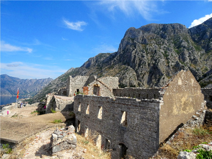 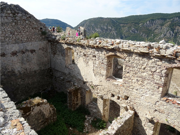 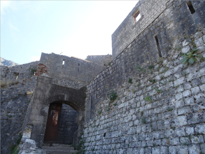 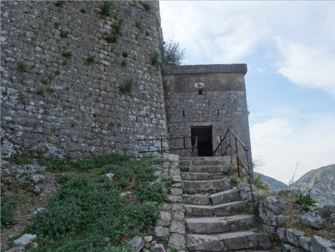 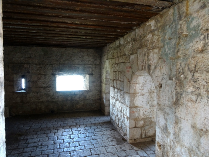 |
|
|
|
|
|||
All Photographs were taken by and are copyright of Ron Gatepain
| Site Map |