


|
|
|
|||||||||||||||
|
|
||||||||||||||||
|
|
|||
|
|
Copalita is located on a cliff overlooking the ocean, ten miles from Huatulco. Its name comes from the large amount of copal found in the area. Copal is a tree resin used as incense during ceremonies, a common substance found across Mesoamerican cultures.
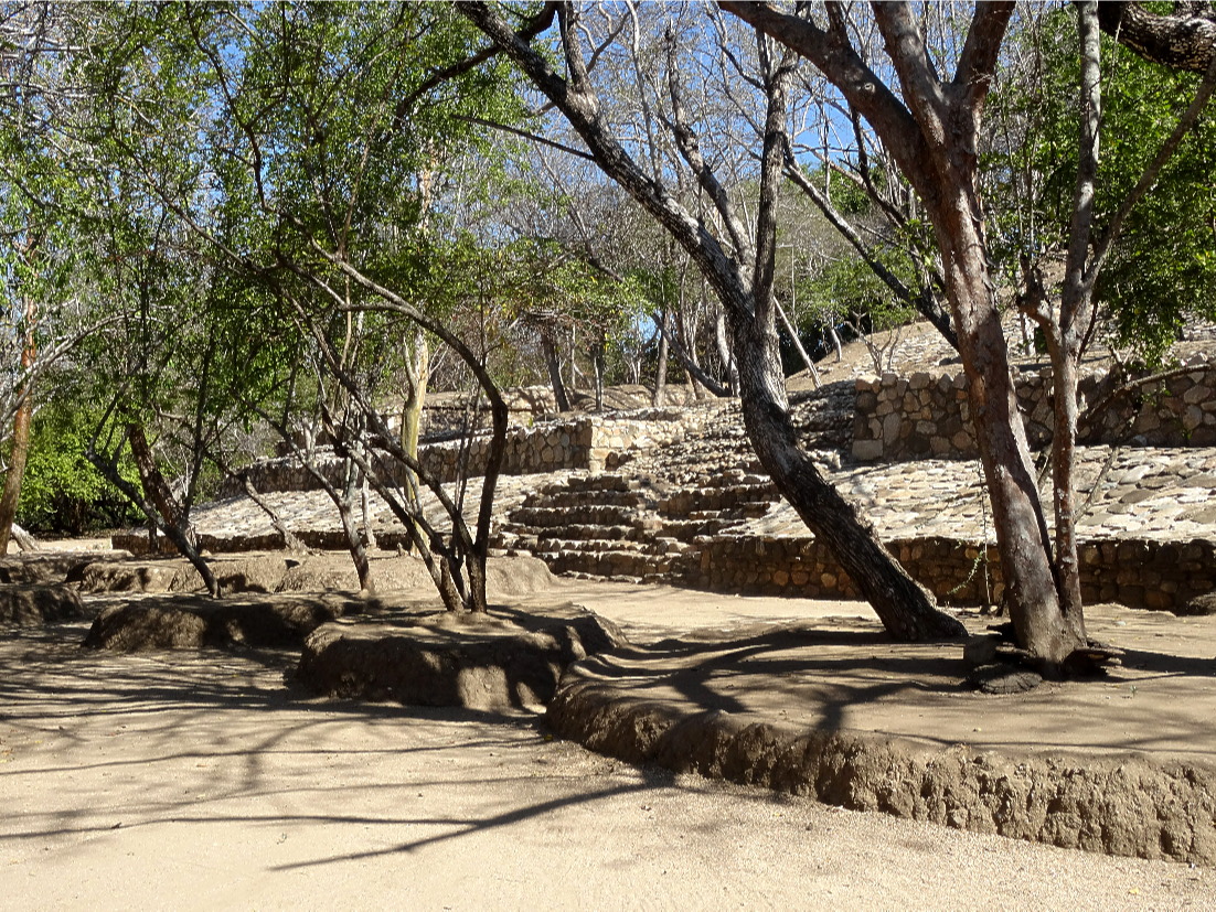
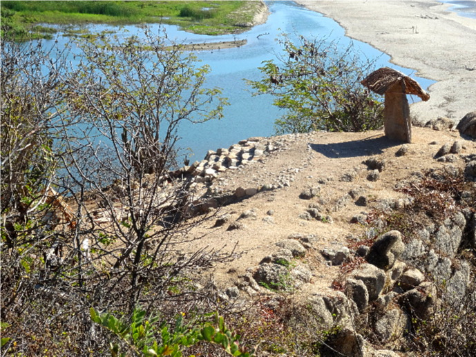
The earliest remains of the site date back 2,500 years from the time of the Zapotec. In fact, Copalita was the first Zapotec archaeological site found in the Huatulco area, and the only site ever built by the ocean on Mexicos Pacific coast. Throughout its history, during its habitation (between about 500 BC to the 16th century) the site has been occupied by a number of different groups including the Mixtec, Aztecs as well as the Zapotecs. It flourished between the 10th and 14th centuries and was probably the largest city on the Oaxaca coast. The people of Copalita lived by hunting, gathering, and fishing, but also by the manufacture of baskets, nets, weights, and floats, both for their own use and to trade. Due to the high acidity of the soil, agriculture was limited, but it did provide a limited amount of products for local consumption, a factor that probably limited the size of the population, which amounted to 2,000 people. Evidence suggests that disease - believed to have been syphilis - struck the population of the coastal region in 1520 30, which may have caused the population to flee the area. The engineering and architecture of the excavated structures show an advanced knowledge of construction techniques. The builders, engravers, and painters adopted architectural styles and patterns from other regions, including Teotihuacan, but they also employed methods unique to Copalita, employing systems adapted to the sites flat areas, as well as the surrounding hills and swampy marshes, creating structures that survived frequent flooding and severe storms. As part of the area was wetlands and prone to flooding, a method of construction was needed to allow for this. This incorporated a foundation of round river stones which would then be covered with flat stones upon which the building would be constructed. Covering an area of around 201 acres, the area of Copalita which is open to the public is only 86 acres, as much of the site has still to be excavated and restored; something that has been continuing since 1988. The area which is open to the public includes a civic-ceremonial centre, consisting of plazas, temples, and a ball court. Visitors today can see the ancient building complex where the ruling class would have lived in the first six centuries BC. These comprise the Ball Court with its large stones engraved in low relief, Pyramids, and some carved stones, and two fairly modest temples including the Main Temple, which is located on top of a natural hill with access through the main plaza by the use of a wide staircase. It is believed that the central section formed the homes of the dignitaries and nobility of the village. This illustrates the construction of the structure and the restoration work that is being carried out. Leading from the site is a path that takes visitors to the top of the cliff which overlooks the sea. This area contains a stone that has been known as the sacrificial stone, but which is also thought to have been used as a reference that would have had a reflective surface to guide the boats to the settlement. Consequently, it is also known as the lighthouse, although, in fact, its location provides a viewing point in all directions. Copalita also has a museum that contains a collection of ceremonial objects such as obsidian knives, jade jewellery, and funeral masks. The items, found at the site, suggest the presence of an advanced commercial city. 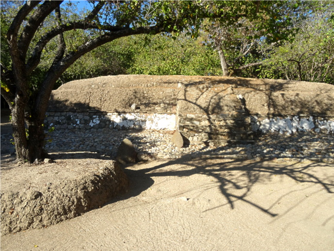 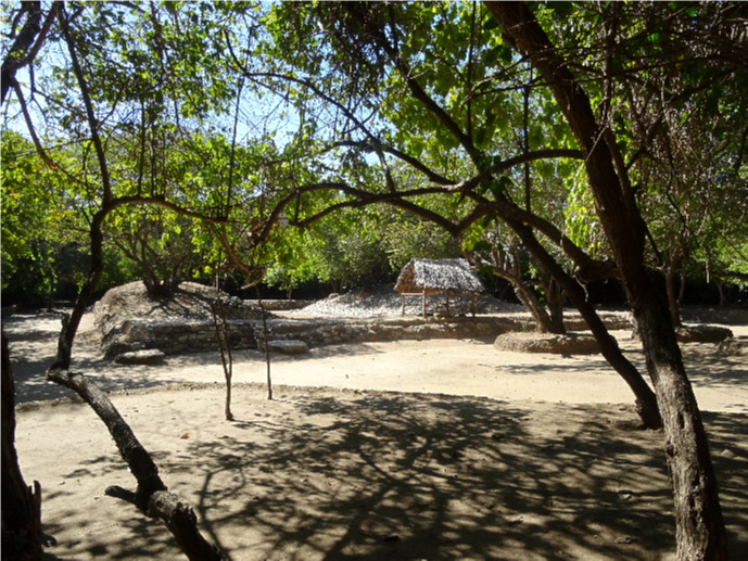 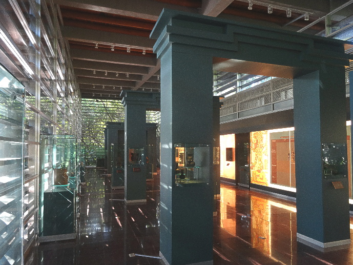 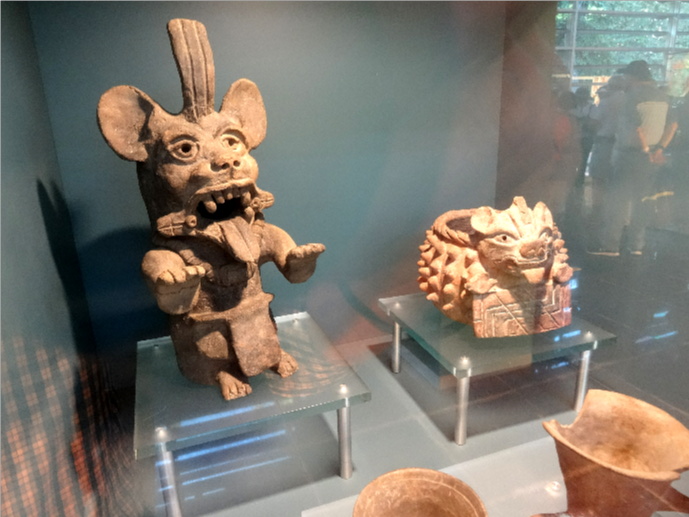
|
|
|
|
|
|||
All Photographs were taken by and are copyright of Ron Gatepain
| Site Map |